Martian Winds
Understanding wind patterns on Mars is essential for
future human exploration and for advancing our knowledge of planetary
climate dynamics. Despite their importance, Martian winds remain largely
unknown. This project analyzes six image sequences from the Emirates Mars
Mission’s EXI 320 nm ultraviolet observations to derive detailed wind
field maps.
Using a cloud-tracking method called Correlation Image Velocimetry (CIV),
wind fields were calculated with time intervals of 10–30 minutes.
Various image pre-processing techniques were tested to optimize CIV
performance, with contrast limited adaptive histogram equalization (CLAHE)
producing the most reliable results.


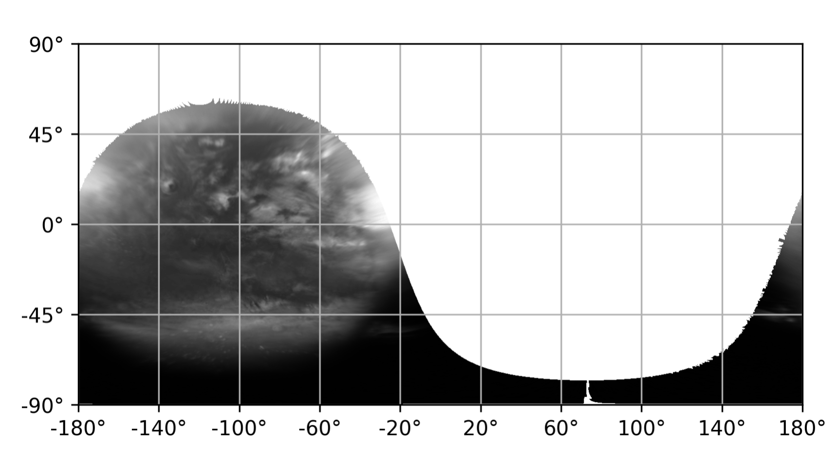 raw image mapped to longitudes and latitudes
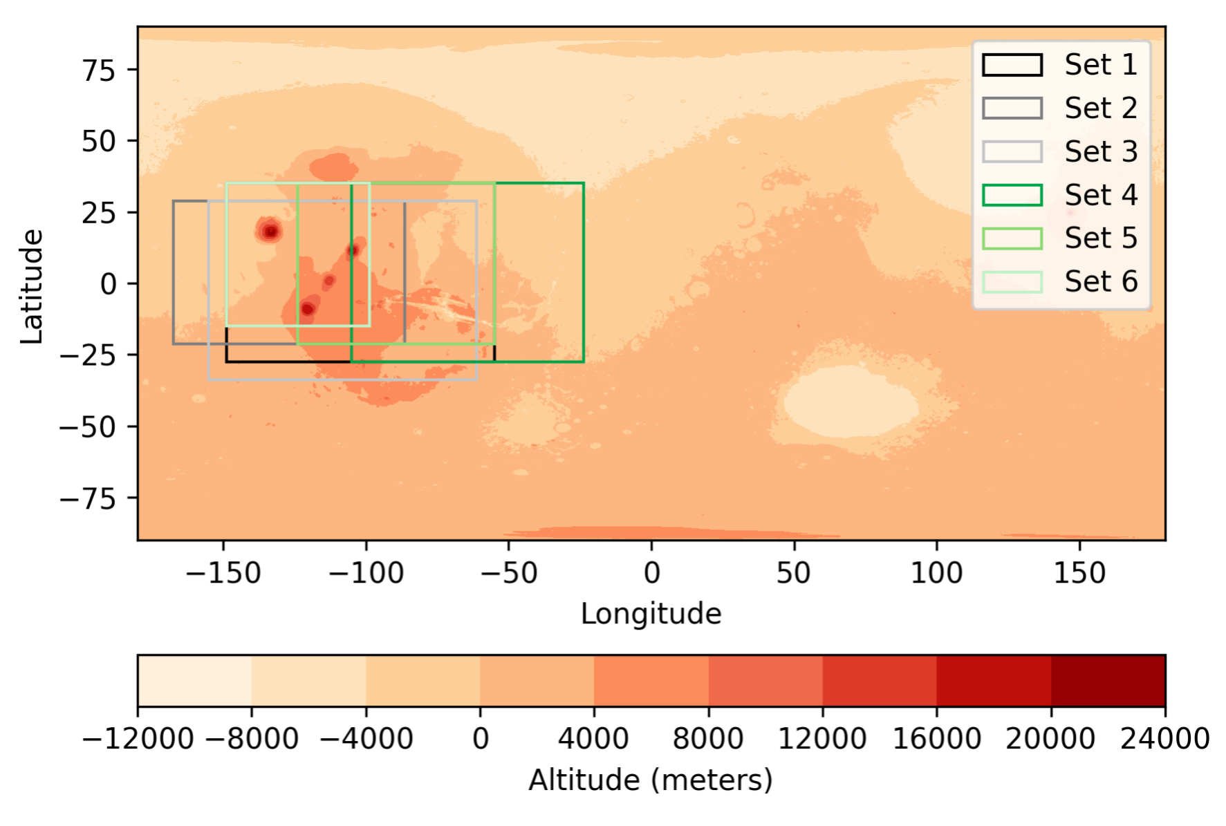 overview of the selected areas
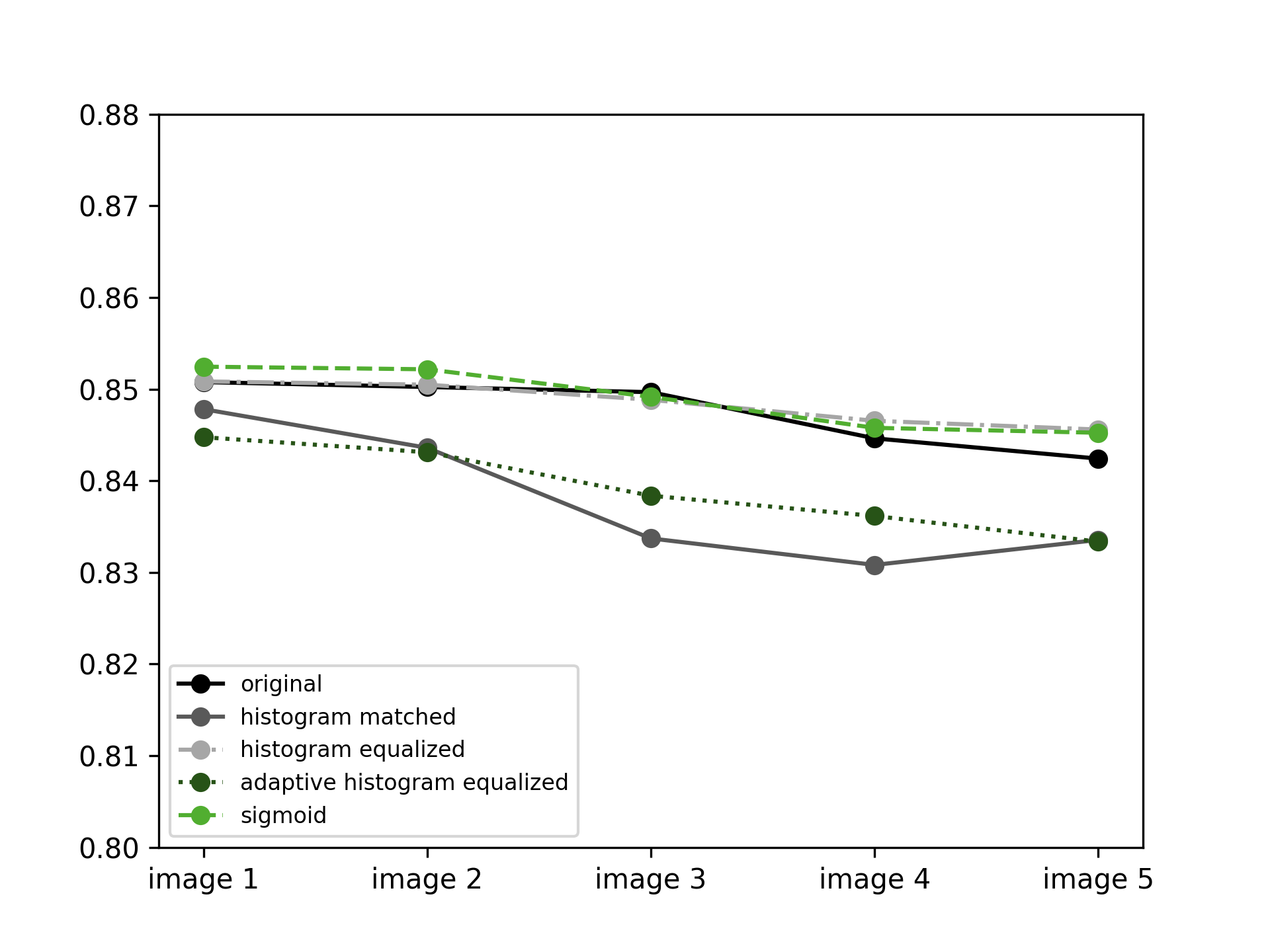
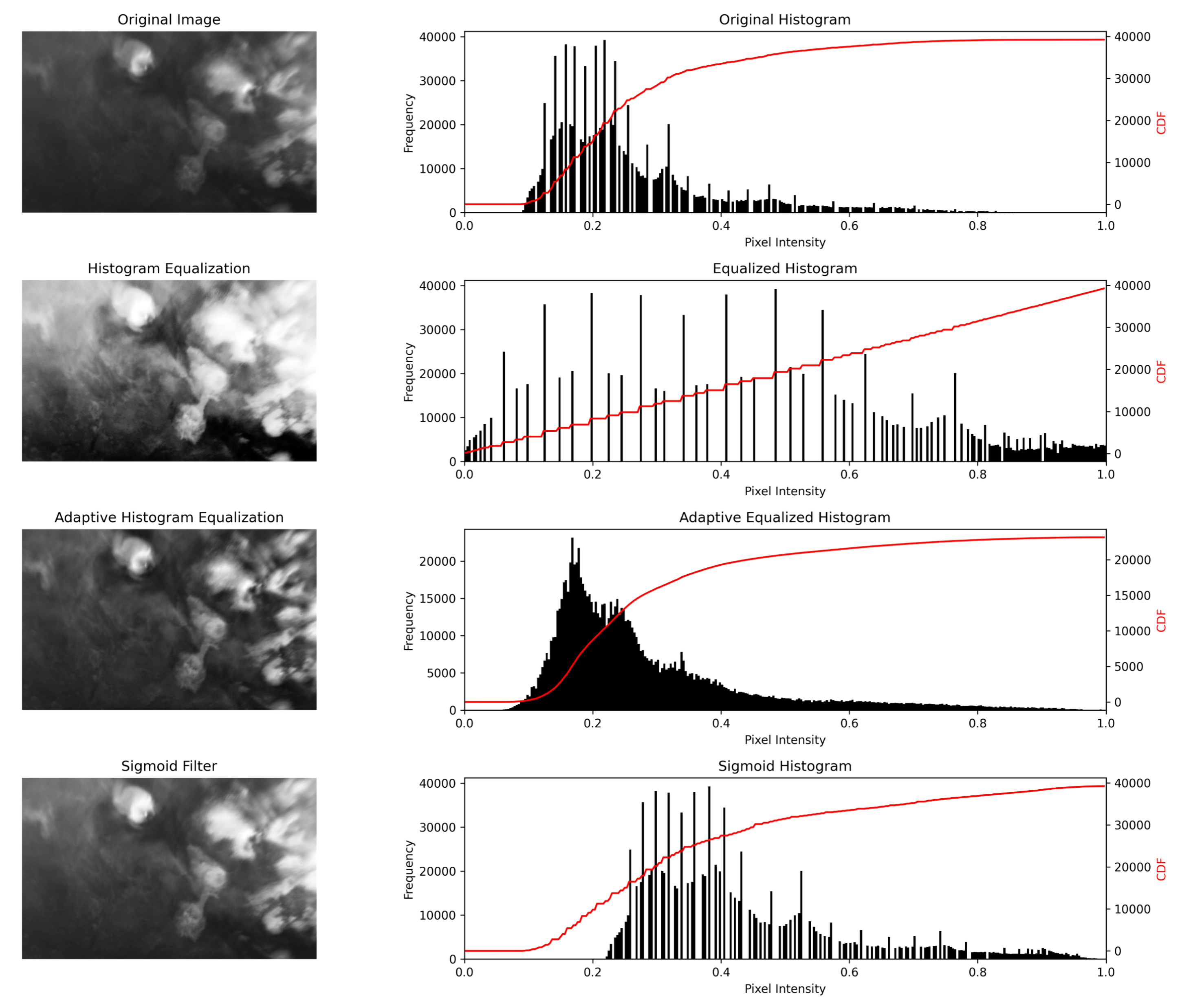 comparison of different image processing techniques
This project involved multiple stages: literature review, data exploration, data preparation, image processing, Correlation Image Velocimetry (CIV), result analysis, and plotting. The raw data came in FITS files, which were explored, prepared, and processed in Python using libraries such as Astropy, Matplotlib, NumPy, Pandas, NetCDF4, and scikit-learn. For the CIV, a cross-correlation–based technique was executed in UVMAT, a MATLAB-based interface.
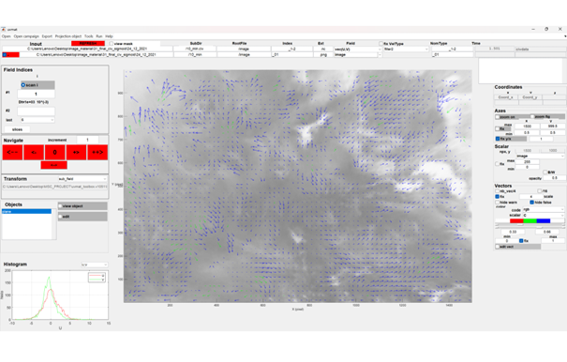 screenshot of UVMAT interface
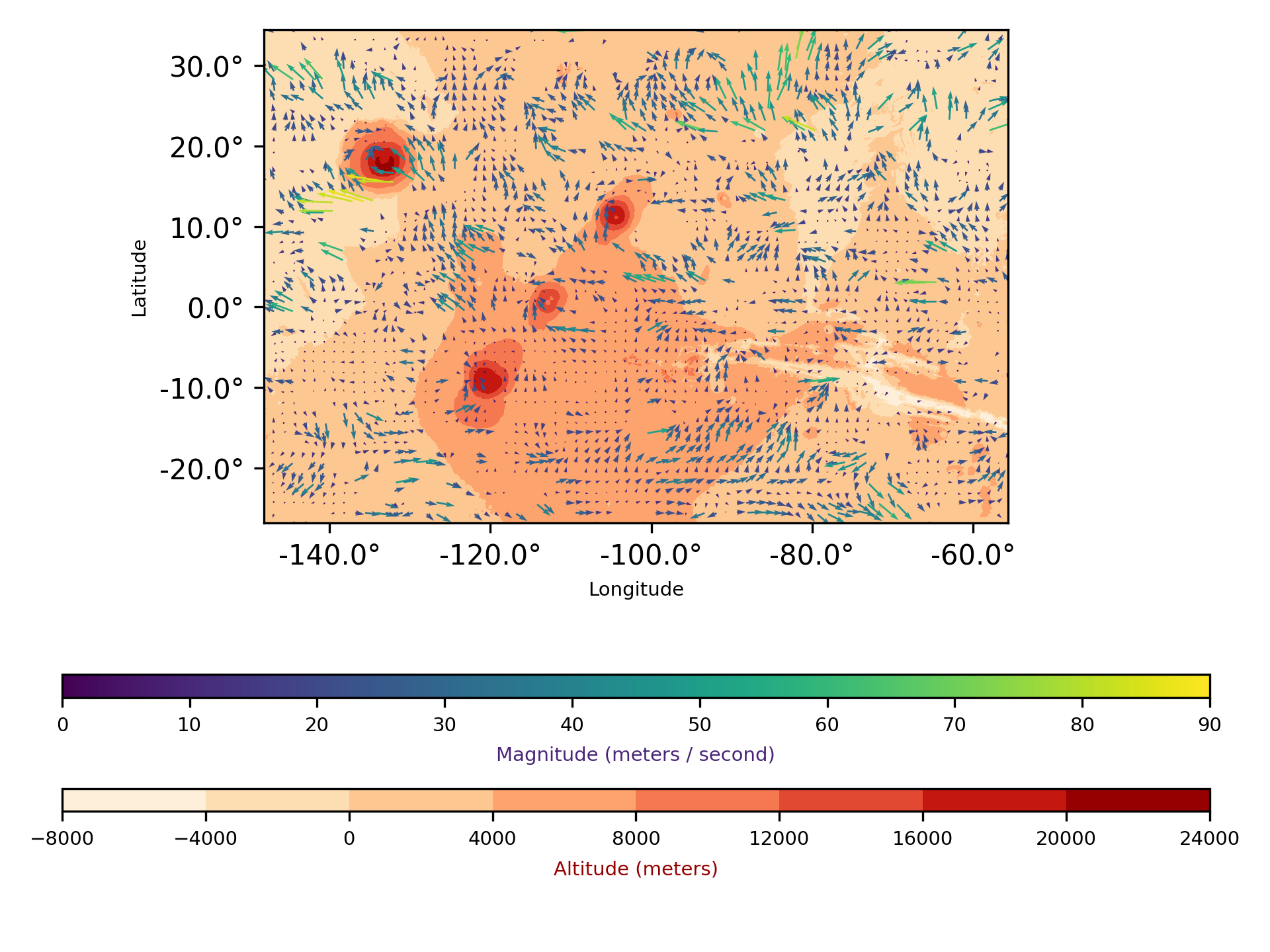 resulting velocity fields
 CIV performance analysis
The CIV workflow consisted of several steps:
- CIV1: Initial velocity fields were calculated using specified interrogation window and shift box parameters; the grid size defined the number of vectors displayed.
- FIX1: Error correction and filtering of vectors above a pre-defined correlation coefficient.
- PATCH1: Smoothness filtering through interpolation and determination of the maximum vector size.
- CIV2, FIX2, PATCH2: The process was repeated using the vectors obtained from CIV1, allowing for refined parameter adjustments and accounting for rotation and deformation.
Velocity fields were then exported and analyzed in Python, where final results were visualized and plotted to provide detailed insights into Martian wind patterns. The project also included careful documentation of methodology, results, and discussion, and was compiled as a thesis in LaTeX format.
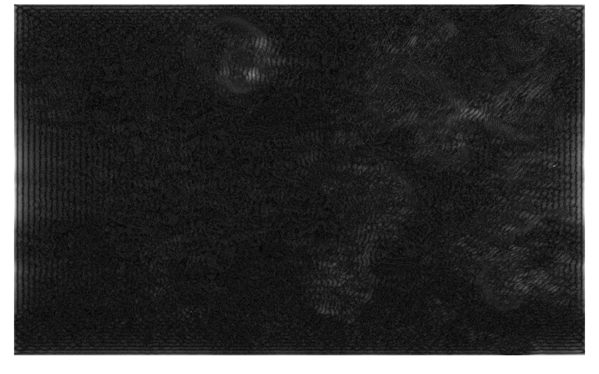 bandpass filter indicating atmospheric waves
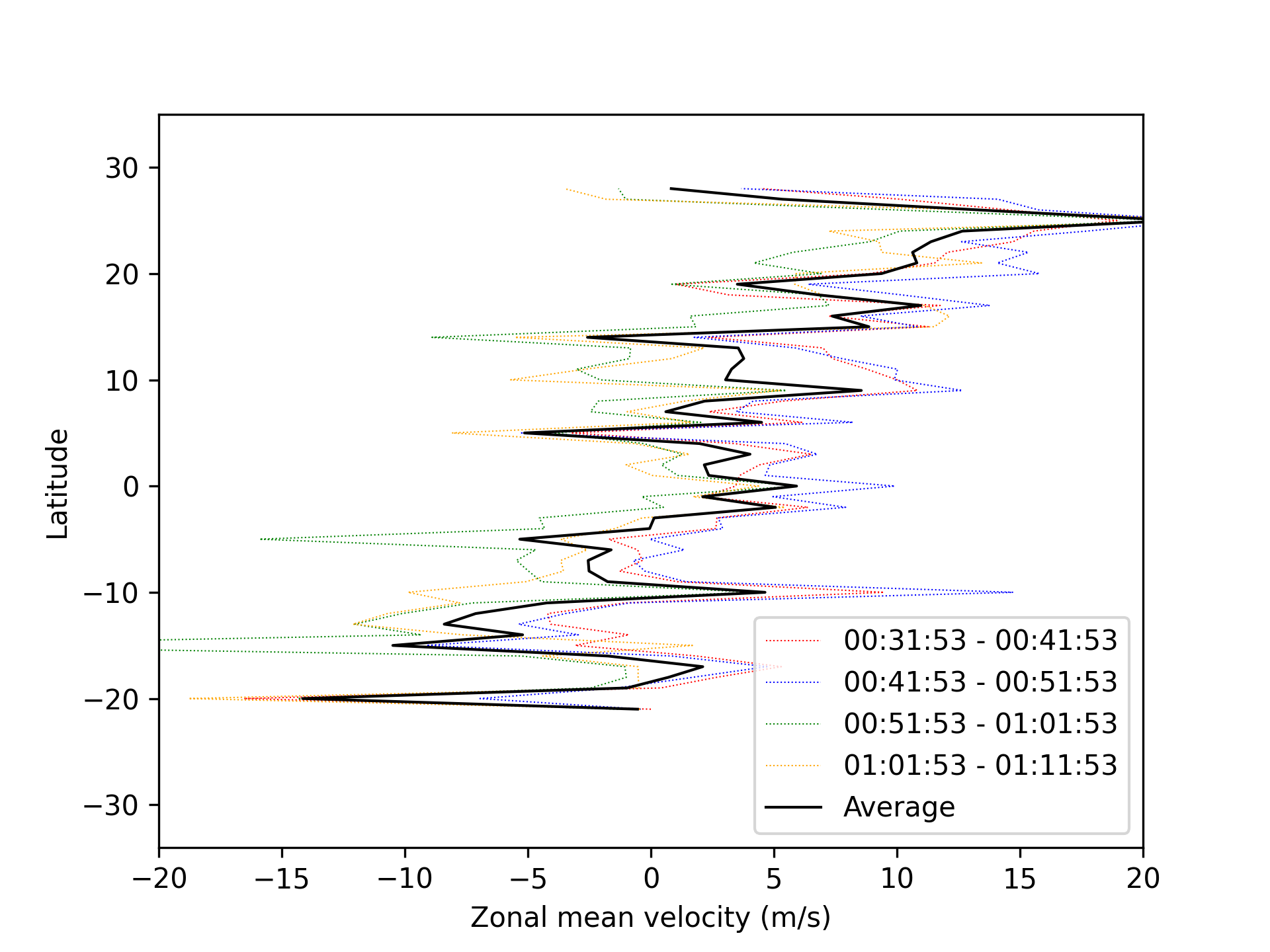 visualisation of zonal means
The analysis of Martian wind fields revealed several key insights. While image processing
techniques improved the visibility of clouds, they did not significantly outperform the
original images. However, using Contrast Limited Adaptive Histogram Equalization (CLAHE)
allowed for the detection of additional velocity vectors, demonstrating the potential of
enhancing sub-regions within the data.
The choice of CIV parameters and input image material had a strong influence
on the final results, showing that parameter tuning plays a critical role in deriving
accurate velocity fields.
The study also identified several limitations. These include uncertainties in
vector direction due to the 3–4 km pixel resolution, variations in solar illumination,
and potential spacecraft position instabilities.
Finally, the work suggests promising future directions. Alternative pre-processing
methods, particularly those focusing on sub-region enhancement, could further improve
CIV performance. Additionally, the appearance of atmospheric wave patterns in
high-pass filtered images points to opportunities for new insights into Martian
atmospheric dynamics.